Tātou Araroa – Chapter 21 – Kia hora te marino, kia whakapapa pounamu te moana, kia tere te kārohirohi i mua i tō huarahi.
(May peace be widespread, may the sea glisten like greenstone, and may the shimmer of light guide you on your way)
Progress: 2847.5km – 94.67%
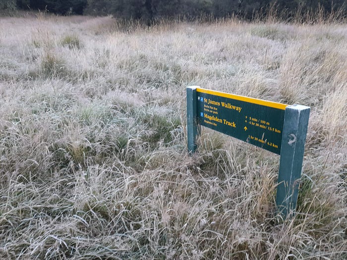
The St James Walkway and Travers Sabine Circuit.

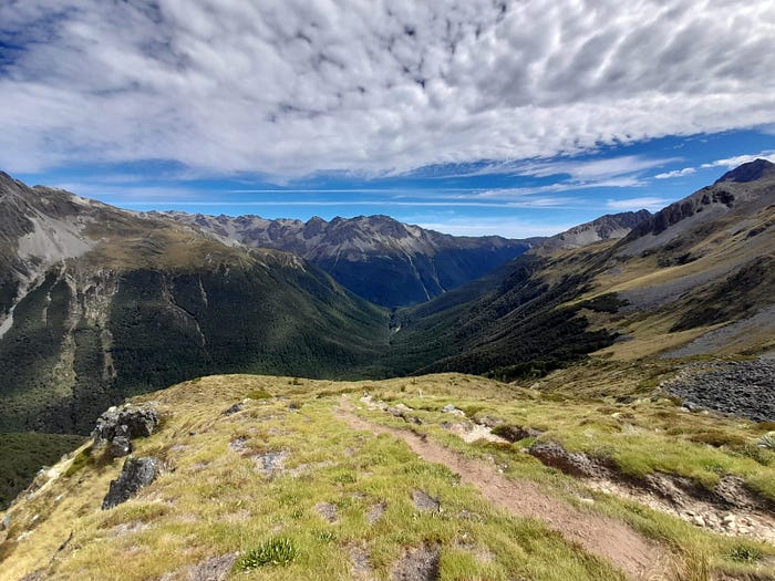
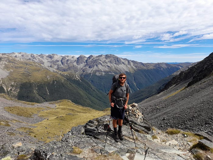
Looking back down the valley from Travers Saddle.
Before we start, an appeal. We are appealing for your support to empower the Mental Health Foundation to carry on their amazing work helping some of the very most vulnerable people. Nearly 30% of us will require treatment for Mental Health issues in our life and the chances are we all know somebody affected by the wide range of issues it can cause. If you’ve enjoyed the blog and enjoyed our journey, we would be so very grateful for your donation. You can do so HERE. We would love to reach $3,008, one for each kilometer we’ve walked, just $224 short!
Ngā mihi, Thank you,
Sarah and Bill
Our trip to the West Coast was a brief but enjoyable one. The tranquil and well loved Trip Inn in Westport was home to us, and our tremendous beef nachos for a night. We hopped on the bus to rejoin the trail at Lewis Pass. Our next obstacle was the St James Walkway, a well used and pleasant intermediate level hike through some stunning country.
We jumped off the bus at the Boyle River Outdoor Education Centre just past Lewis Pass. We had sent a box of food onwards here so headed in and picked up our predictable cache of tuna sachets, couscous bags and granola. Wishing we’d been a bit more lavish in our culinary plans, we filled our food bags and pressed on.
The track follows and crosses the Boyle River as you dip in and out of open country and beech forest. The towering Poplar Range forming one side of the sweeping valley and the exotically titled Libretto Range the other.

Boyle Flats Hut from across the Boyle River
Contrary to the stunning weather we’d had on the West Coast yesterday, it had been very damp here and the trail was muddy underfoot. We greeted the mud as an old friend and continued on our merry way.
Bill’s shoulder was beginning to play up, the combination of a freshly restocked, and thus heavy, bag and the fast going (more speed = more impact) were causing a bit of strife. So we opted to do a hugely rare thing for us and put our headphones in. Sarah listening to the Barack Obama’s inspirational autobiography “A Promised Land" and Bill to the slightly less highbrow Off Menu Podcast (2 comedians interview a different celebrity each episode and get them to choose their perfect dining experience). It helped pass the time well and even Inbetweeners actor Joe Thomas choosing a cheese ploughmans as a dessert in his dream menu couldn’t dampen the mood.
It was only a short 12km that day so we quickly spotted the modern and luxurious Boyle Flats Hut across the river. We hopped across the rather bouncy swing bridge (it’s always fun when the bridge stipulates a one person at a time maximum) and rolled into the tidy abode. An afternoon of chatting with the Department of Conservation Rangers was followed by a very tasty, if only for its variety, potato and spinach curry and then an early night.

Rich blue skies in the Boyle Valley
The quiet and respectful residents of the hut provided the perfect environment for a monster of a sleep. We had got into bed at 7.30pm and slept almost interrupted until our alarm chimed at 6.30am. We took a few minutes to adjust back to the world of being awake and clambered sluggishly from our bed.
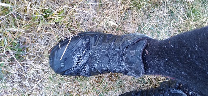
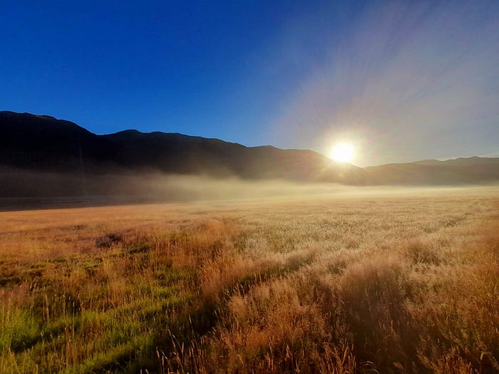
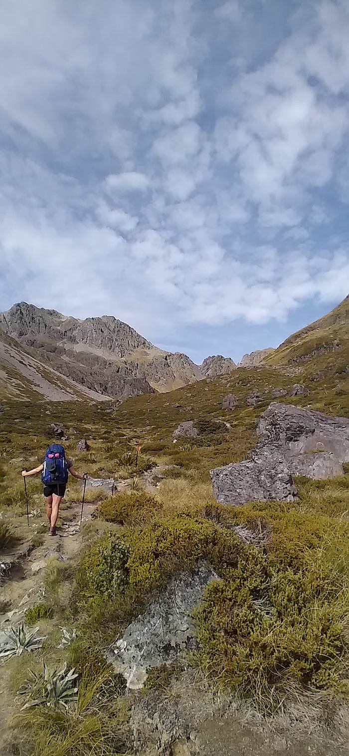
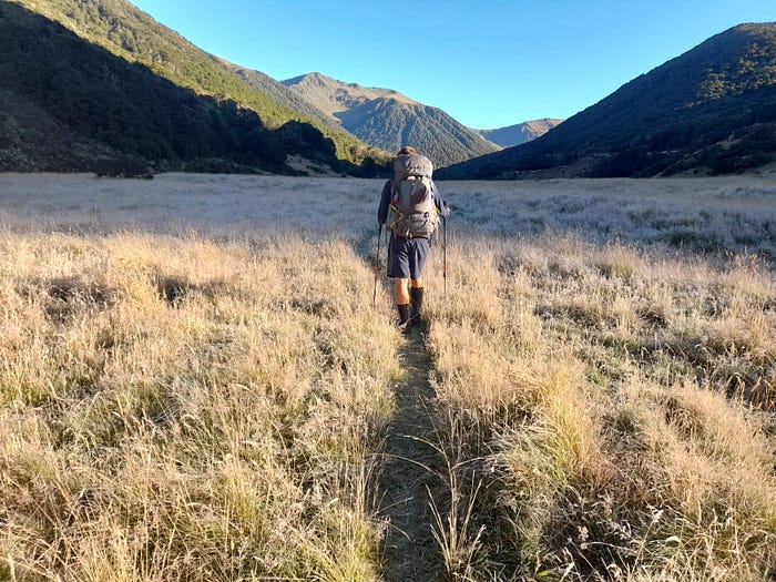
It feels like each section we walk has one “Big Day” and today was St James Walkway’s turn. We were walking from Boyle Flat Hut to Christopher Hut, via Anne Hut. The map in Boyle Flat Hut suggested it was 6 hours to Anne and a further 4.30 to Christopher. The day started poorly for Bill, he fell into a frigid stream whilst filling up the water bottles, soaking his feet and legs in the process. The most notable thing about the morning was that, on February 18th (Northern Hemisphere equivalent: August 18th) there was a heavy frost on the ground. We were around 1000m above sea level so that played it’s part, but it was bizarre after the blazing heat of yesterday and the huge high pressure system sat over the entire country. Wrapped up warm, we re-crossed the bridge from yesterday and began our day gliding through frost dusted tussock by the Anne River. Bill’s tumble in the river this morning now less comic as the water in his shoes now turned to ice and encrusted his boots with a glacial shell of frost. The undulating nature of the surrounding environment meant we alternated between sun and shade for the first few hours of our day. The sun’s warmth thawing us before entering more frost covered vegetation. Our first milestone for the day was Anne Saddle. A gentle 400m climb was spread mainly evenly over the 8km approach from the hut, with inevitable little ramping up of gradient before the high point. Buoyed by our great night sleep, and to prevent us becoming icicles, we covered this section rapidly.
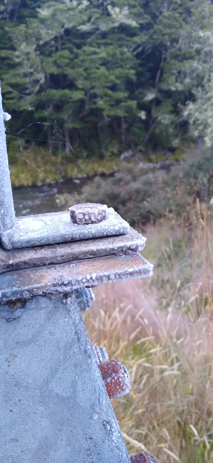
Some pictures from a chilly morning
Following the Saddle was the gentlest of gentle descents, fortunately passing over the Saddle had now placed us in a valley where the conditions were far better suited to the sun’s position in the sky and thus were treated gratefully to its warm embrace. The easy to follow trail now dropped into a vast valley bordered by the gigantic Mount Federation on one side and the many peaks of the Opera Range on the other. Surrounded by glorious scenery and walking on the mainly flat riverside path, we made great time and reached Anne Hut at 12.30pm for an early-ish lunch. Anne Hut was incredibly clean and modern, but its position right in the middle of the valley surrounded by little vegetation earns itself the nickname of “the most exposed hut in NZ".
We dined well and headed back out at 1.00pm. Following the morning’s chilly start, it was now baking hot.
The view from Anne Hut
The valley was still and the grass, tussock and rock provided us no shelter from the now boiling sun. Fortunately being near the river meant stops for water were frequent and easy. An hour after lunch the track splits into two, one branch follows the Waiau River into and over the Waiau Pass and the other continues on the St James Walkway as it turns into the Ada Valley and over Ada Pass. We turned to follow the Ada and enjoyed the tremendous views the confluence of these giant valleys provided. The joy was a little short lived as the condition of the track soon degraded however. The grass grew longer and the camber of the track grew more unpredictable. Many times it would happen that 20 steps on a certain line would be followed by a ankle breaking hole randomly placed unseen under the long grass. We spent an hour grumbling in the now intense heat about the trail. To add to our frustration we were walking above, but parallel to, a beautiful river that looked hugely inviting as both a water source but also potentially as a pathway itself. Fortunately as we headed further into the Ada Valley, the river meandered towards the center of said valley providing a flat and open space for the trail to adopt. With around 5km to go we opted for the headphones route. Sarah again listening to Barack Obama and Bill to “Quickly Kevin, will he score?” (a hugely nuanced podcast based on English football in the 1990’s. This particular episode centered around peculiarities of lower league stadia during the period.) With us both wilting in the afternoon heat, we consulted the map and were delighted to see the Hut was just 800m away. We hurriedly finished up and piled gratefully in the shade of Christopher Hut.

The Anne River
The 12 bed hut was our own for the evening which was nice. Dinner was the usual fare but our pre-bedtime hot beverage was a hot chocolate which we added some actual real dark chocolate too for added creaminess. A girl from Boyle Flat Hut the night before was heading back into the real world and wanted to get rid of weight for her last day, hence why we had real chocolate.

Christopher Hut
As is seemingly becoming a theme, we slept incredibly well. The hut retained so much of the late evening heat that only our silk liners were needed for warmth overnight. We had just the 5 ½ hours to walk that day so a slow start saw us remain in the hut until 9am. When we did set off it was again following a river and gently undulating in soft beech forest. Views of the wonderfully named Faerie Queens, a name given to a range of peaks in the Spenser Mountains, provided a breathtaking backdrop through the trees. Ada Pass was our first landmark. When you think of mountain passes it conjures an imagine of an intrepid explorer inching their way up a snow covered cliff in a blizzard using an ice axe and crampons. Ada Pass however was marked by a small sign just off a flat and wide boardwalk. Pass successfully navigated, we strolled the remaining distance to Ada Pass Hut with ease. It was headphone time again and Sarah continued onwards with Obama’s rise to power whilst Bill’s podcast de jure was the “No such thing as a fish” Podcast. Created by the people behind QI, the irreverent show discusses interesting facts and other bizarre idiosyncrasies in life (Did you know that, less than a year before inviting the lightbulb, amongst other things, Thomas Edison narrowly evaded death when he was riding on the very front of a train and it hit a badger?)
A stunner of a sunrise out of Christopher Hut
Our mutual engrossment in our respective podcasts meant we covered distances quickly. After a brief lunch in the wonderfully situated Ada Pass Hut, we carried on and reached Cannibal Gorge Hut just an hour later. The guide for this track explains the etymology of this Hut and Gorge as “the site of a Maori battle and subsequent victor’s feast. This grisly reminder of a violent past is now a peaceful walk through mature red beech forest with occasional glimpses into the deep canyon below”.
View from Ada Pass Hut
Cannibal Gorge Hut is equally as idyllically placed as Ada Pass, with cracking views of the rocky peaks of the Spenser Mountains all around. The Hut was empty and cool, providing an oasis from the stifling heat outside. We came inside, had a cup of tea and relaxed. Just three hours to go until the end of this leg and a potential rest day in the town of St Arnaud on Sunday.
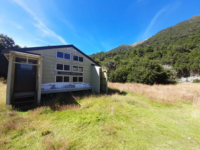
Cannibal Gorge Hut
Waking up at Cannibal Gorge Hut at 6.00am, our usual “Big Day" alarm time, we realised a truth looming over us for a while, we have been walking so long now, and walking North, that the days were shortening. A 6.00am wake up meant pitch blackness. So a 6.00am alarm immediately become a 6.30am alarm. We packed up and headed off just past 7.00, committed to making this three hour section take two. We needed to get out to the road end early so we could hitch to the start if our next section. Logic would suggest it might take three hitches to cover the not long, but convoluted route to St Arnuad and the start of the Travers Sabine Circuit. We smashed out the remaining distance very swiftly , our light bags facilitating light feet.
We got to the road and up went the thumbs. We haven’t hitched much, but you get to build a good instinct for who might stop. Driving a pristinely clean 4x4? No way! 1987 Toyota Camry? There’s a chance! 15 minutes pass to no avail until around the corner comes a mid 2000s Mazda 3. The dirty tan color of the little hatchback suggests the owner has had a lapse in judgement in the past and might err again by stopping for us. Sure enough the indicator comes on, it pulls over and the window is lowered. “Where you heading?” Paul (“my mates call me bad santa") enquires. We answer, he says he’s heading to Nelson (pretty much on the way) so we hop in. White bearded Paul (hence the festive nickname) is driving to Nelson Hospital to pick up his Mum who’d broken her arm in a fall. Paul is reluctantly bringing his mother back to live with him for a few weeks while she recovers. It turns out his mother had emailed him a list of foods she will and will not eat. You sense he is in no rush today. The normal route to Nelson would mean dropping us of at the St Arnaud turn off from State Highway 7 and would mean hitching the final 25km into town. Paul however turns right and drives us to the doorstep. We reiterate again the sense of procrastination in his actions. We thank him profusely, we had scheduled a full day to hitch so this rapid miracle means it’s just 11.30am.
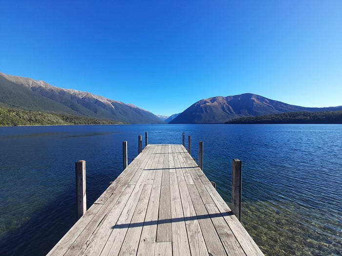
Lake Rotoiti by day

Lake Rotoiti by dusk
Paul has dropped us off at the Alpine Motel, this was useful for us because we had sent our second foodbox here ready to pick up before the next section. Bill went in and picked up the, sadly very predictable, anti-smorgasbord of tuna, couscous, granola and peanut butter. The usual suspects. Bill also enquired about a room for the night, it had been a while without a nice bed and a shower, the $170 quote sent us down the road to the campsite. Tent up and belly’s rumbling we head back to the Alpine Lodge for one of their famous Pizzas. Pizza and chips did not disappoint, nor the Sprig and Fern American Pale Ale and her fruity and delicate flavorings. Feeding time over, we went back to camp, got changed and went for a swim in the marvelous Lake Rotoiti. It was chilly but manageable and wildly refreshing. We dried off, headed back to town for fish and delectable beer-battered fries then an early night.
Sarah had a tough night and did not sleep well. The 6.30am alarm was summarily dismissed and the morning was a slow one. We eventually caught the boat to the track start at 10.30 and began our walking in earnest at 11.00. John Tait Hut was a 14km journey from the wharf following the Upper Travers River. We had been treated to such well made and clear tracks on the St James that the jagged and rooty path slowed our pace significantly. The heat didn’t help and neither did our Sandfly -induced inability to have a break (the minute you stopped they swarmed in and cause pain, itching and high stress). As is often the case, the short days are the killers. We gradually got there though as Mount Travers came in to full view further the up the river bed and, following a number of bridge crossings, undulating track and open tussock, we arrived at the riverside John Tait Hut. We bundled in the door and quickly consumed the Green Onion Bluebird chips we failed to eat in town yesterday. The modern and cavernous 27 bed hut played host to just us, Tim (a wiry and instantly recognizable as a tramper, TA SOBO walker) and Mark who is touring the country on his motorbike and with his camera. The 11 days of food in his bag contributed to his arrival some hours after us despite being on the same boat. A dinner of a very strange tofu curry, rice and peas filled our bellies and readied us for an early night.
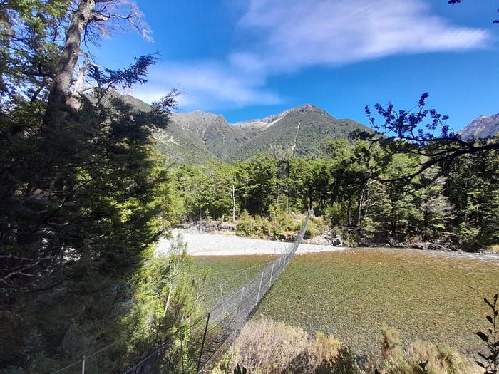
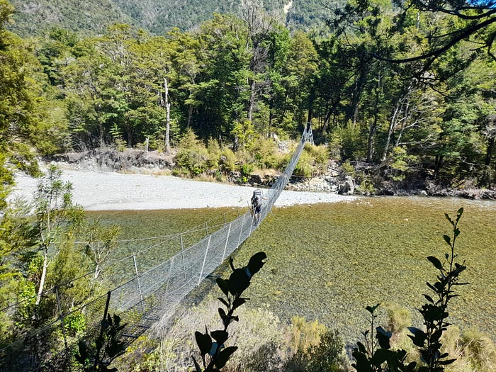
Bridge across the Upper Travers River
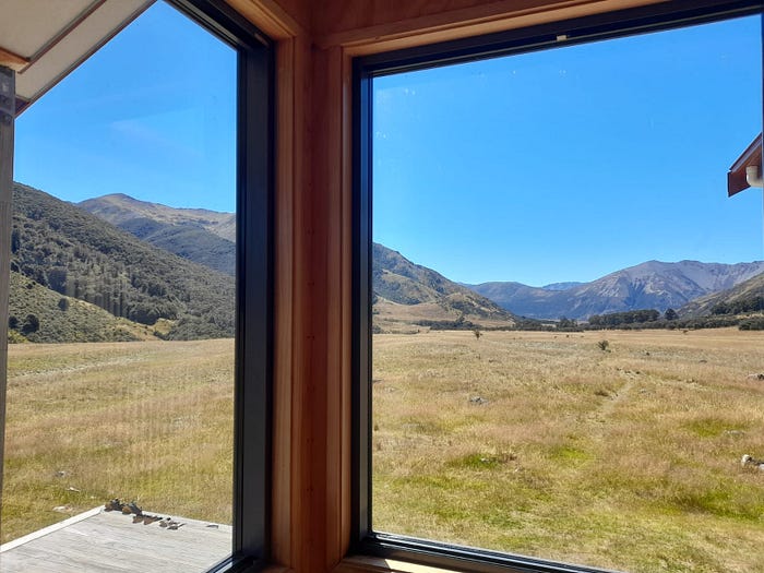
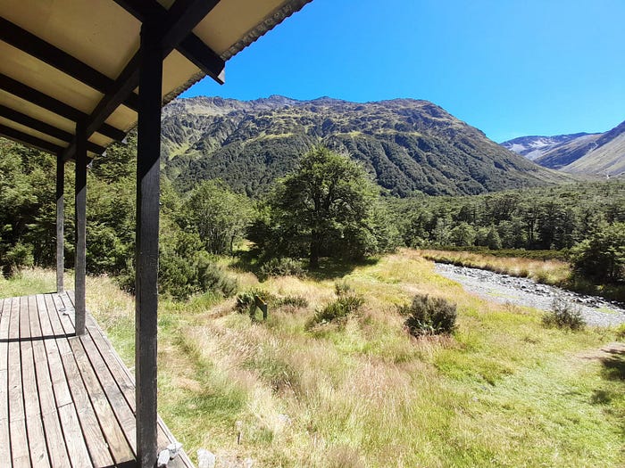
As with the St James Walkway before, Travers Sabine Circuit has a “Big Day” too. Today would take us to the end of the Travers Valley, up and over Travers Saddle, at 1700m, then down 1100 meters to the Sabine River and our destination for the day, West Sabine Hut. Nothing for it then but to have an early start and get it done. The first step was the 5km between us and Upper Travers Hut, a steady 300m climb along the crystalline Travers River was a breeze and covered well ahead of DOC’s suggested time. Upper Travers Hut sits in a natural amphitheater between the St Arnaud and Travers Ranges and is, in our opinion, one of the most picturesque huts in New Zealand. An ideal place for a little morning tea. Tim joined us shortly afterwards and echoed our wonderment for the location of the Hut.

The beautifully perched Upper Travers Hut
The climb towards the saddle became significantly more steep past the hut. The Ranger we had met that morning suggested it would be 75 minutes from hut to saddle so we readied ourselves for some hard work. It was hard work, it was steep and rocky and long, but we loved it. We loved it because the view behind us was spectacular with Kehu Peak and Rainbow Pass exuding monolithic wonderment. The view ahead wasn’t bad either, with snow spattered Mount Travers looming large above the saddle.
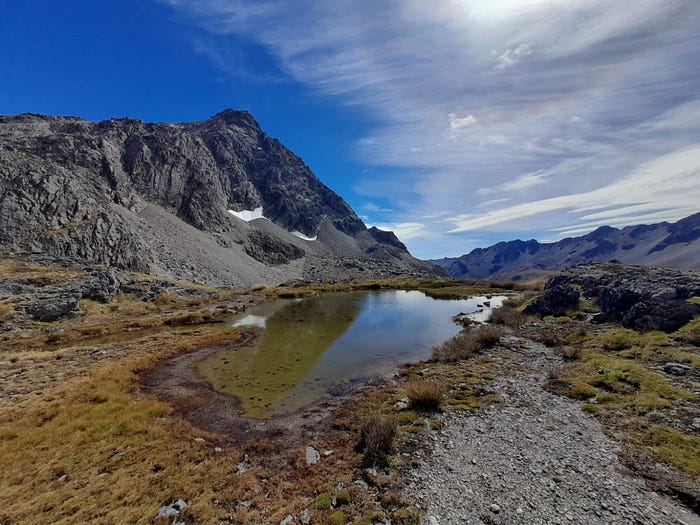
A tarn beneath the snow spattered Mount Travers
We pressed on upwards, scrambling over rocks of various sizes. We were enjoying ourselves enough to take humour in the multiple false peaks (or false saddles in this case) but were delighted when we reached the saddle proper. The view from the saddle down the Sabine River was incredible, easily in the Top 3 views we’ve seen in this entire odyssey. Franklin Ridge in the foreground dwarfed by the Mahanga Range across the valley. It was overwhelming to look down at the tiny river below and know that was where we were heading. It is a strange feeling to look at over 1100m of vertical descent and begin inching your way down.
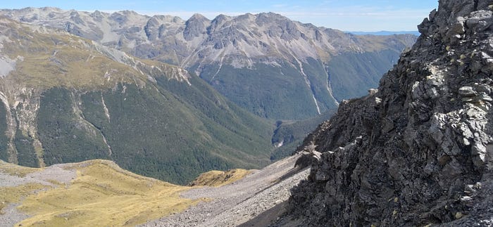
Some views down from Travers Saddle to the Sabine Valley
Progress was glacial, it was incredibly steep. Lose rocks acted like marbles and the track demanded great focus to prevent a fall. It is at times like this when you are incredibly grateful for your walking poles, they are your strongest ally in the dual struggles of gravity and momentum on a descent. Loose rocks became boulders became a narrow spur, but eternally downhill. Eventually we entered a sparse beech forest and then trail became less directly down and switch backed somewhat. Whilst we were grateful for the shade of the trees and the slight easing of gradient, it meant we lost our panoramic view of the valley below. We carried on downwards as the trees became gradually more dense and the trail became more roots than rocks, again a welcome change for us.
A check of the map showed we had dropped 700m and had 400m to go, the 700m had been covered over only 2.9km and the remaining 400m was over 3.6k, in summary, mathematically at least, it should mellow somewhat. It did mellow a touch, with at least some flat relief between drops. The noise of the East Branch of the Sabine River was increasing, a positive sign that we were making steady progress. Finally we spotted the aquamarine river through the trees and our knees breathed a sigh of relief, we were almost done with the down. We had a brief stop for lunch and fueled up for the final 2km to the hut, the map indicated we would cross the East Branch, sidle the lower sections of Mount Franklin and then the hut would be at the confluence where the East Branch meets the West Branch and it becomes the Sabine River.
Sometimes lunch comes and goes with no noticeable boost, but today it supercharged us and we conquered the remainder quickly. It had become very hot so we headed down to the river after we arrived at the hut for, what can generously be described as, a splash around. It was impossibly cold but refreshing and essential after the day’s sweaty end.
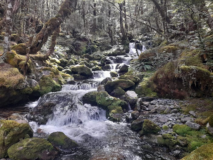
A verdent creek in the Sabine Valley
The hut was boiling, the harsh afternoon sun had roasted its snug confines. It was busy too and the multiple cookers combined with body heat only added to the warmth. Unfortunately, being by the river, there was a huge colony of Sandflies all around so opening a window was out of the question. Eventually it cooled down enough, and our hut buddies finally turned out their head torches and we still managed to salvage a decent enough sleep.
6.30 alarm was callously disregarded and we sluggishly rolled out of bed at 7.00. 7.45 and we set off for a day of 2 parts. Part One was West Sabine Hut to Sabine Hut on the shores of Lake Rotoroa. We started out crossing the Sabine River on another lovely one person suspension bridge.
A DOC Ranger we met had described the next section as “a dog" so we were looking forward to that. It wasn’t terrible, but it was slow, rooty and energy sapping. The track sometimes led high into the banks of the river on slippery and awkwardly angled roots, sometimes it would drop you onto the river bed itself and often through muddy pools on the forest floor. Glimpses of the surrounding mountains softened the frustrations, but we knew we had 5 hours walking left even after we got to this first hut so we were keen on making quick time and we were not. The Sabine River was a constant companion to our right, it varied at times from a wide shallow expanse to a deeply deeply gorged rapid raging river. It remained eternally turquoise and stunning in the rays of sun shining through gaps in cloud.

Lake Rotoroa
Eventually we reached a sign – “Sabine Hut – 30 Minutes", this energized us hugely, even more so when the edge of the mountain rimmed Lake Rotoroa came into view. 30 minutes took 20 and we lunched in the lakeside Sabine Hut, knowing we still had five hours to go, we took drastic measures and ate an extra wrap each. Desperate times call for desperate measures.
Speargrass Hut was the next waypoint and our destination for the evening. The walk would take us up and away from the lake to sidle the west side of Mt Robert some 600m up from the lake. The trail was better, but still somewhat slow due to windfall (fallen trees). Fallen trees are always fun because you have two options; “The Turtle” or “The John Wayne". “The Turtle” being an undignified crawl under the tree hoping your shell (your bag) will squeeze underneath without trapping you on the ground. “The John Wayne” is the up and over approach which often leads you straddling a large trunk of wood, legs akimbo like you’re riding a horse. Neither method are quick and both sap the energy when repeated often.
The climb at least offered a challenge which helped to engage us. Bill was struggling due to not drinking enough water so stops were perhaps more regular than would have been preferred. We carry electrolyte sachets for these purposes so we filled our drinks bottles with them and rode the gloriously artificial energy boost up the hill. Upon conquering the vertical challenge away from the lake, it was now a case of working our way around the gigantic Mount Robert before dropping into a hollow by Speargrass Creek, home to its eponymous hut. Our efforts received a significant boost when we had a moment of Te Araroa déjà vu, much like on the ridgeline of Mt Pirongia, some 2000km back, we were presented by a gift from the gods: surprise boardwalk. The elevated boardwalk, built to protect the fragile wetlands beneath, went on for perhaps 2km but more importantly, allowed us to stretch our legs, develop some good flow and to give our tired minds a rest from roots and fallen trees.

Speargrass Hut with Mount Robert in the background
Aided by this wooden pathway to heaven we made great time and, when the boardwalk finally finished, we dropped down quickly and spotted the hut rising like a temple amongst the long grasses of the hollow. It had been a monster of a day both physically and mentally but we had made it and felt good knowing we had just the two hours or so to the road end the following day.
We slept incredibly well in the warm hut and sprung out of bed the following morning at 6.30. We smashed down breakfast (and a tea of course) and were on our way. We made excellent time on the undulating but easy enough track through the forest and made the road end by 10am. Unfortunately the road end was not THE end for us and we had to walk a further 90 minutes until reaching a highway and providing us with the chance to hitch to the start of the next section in Nelson. Fortunately the hitch came quickly and we made Nelson by 1.30pm.
Nelson is a special place for us, it will be our home after the walk, we have been living in Auckland for nine years and are relishing the prospect of a new life on the South Island. A small percentage of our love for Nelson is reserved for the fantastic Burger Culture where we had lunch. A slow cooked harissa lamb burger (Sarah) and a spicy chicken, bacon and cheese burger (Bill) were accompanied by the obligatory chips and the exquisite “sweet corn ribs" (chargrilled corn on the cob quarters with heaps of spice and crispy onions). Following lunch Bill got his haircut before we retired to the Bridge Street Backpackers which will be our home for two nights.
What’s next?
This is it everyone, one final section. Nelson – Pelorus Bridge- Havelock- Queen Charlotte Track – Finish. DONE.
A reminder: please consider donating to our cause, if you’ve enjoyed this blog and our previous work it would mean so much to us to support this vital cause. The link again is HERE
Bonus pictures:
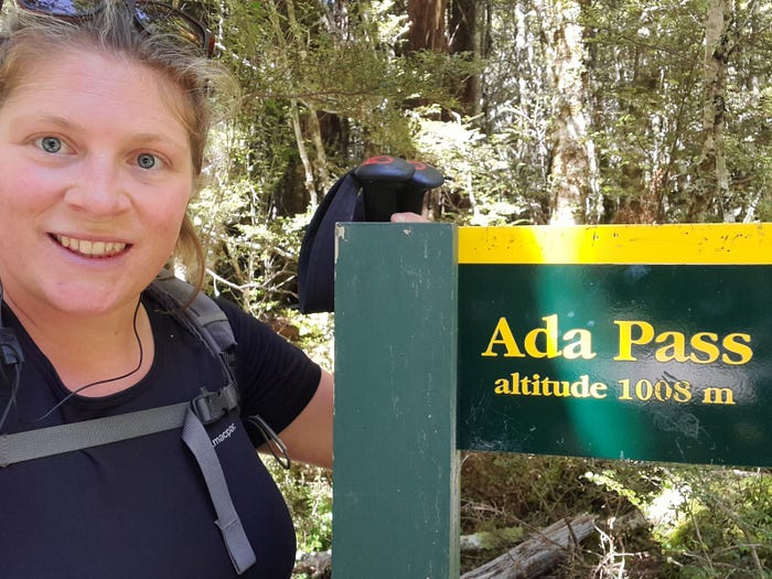
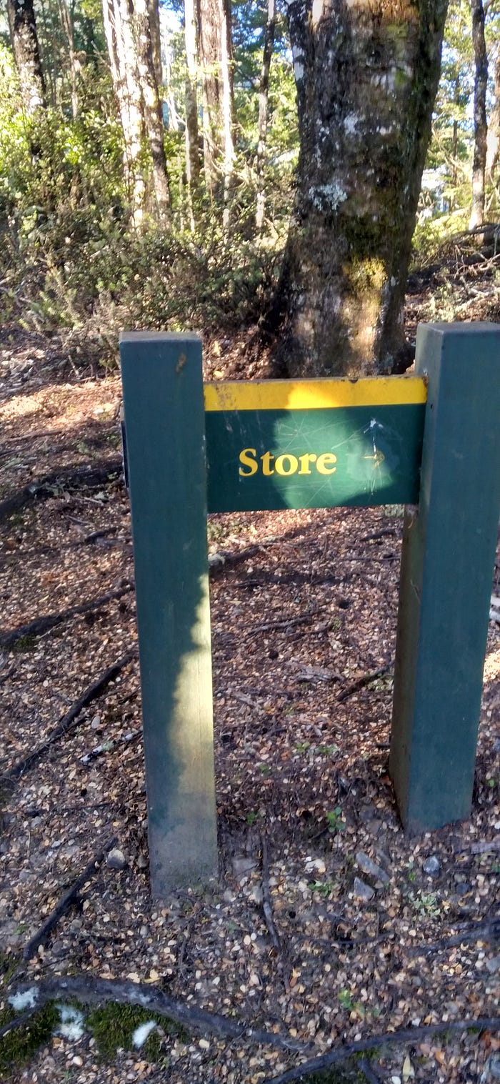
Top to bottom: Bill crossing the Upper Travers River; Bill in the frosty Anne Valley; Sarah at the tame Ada Pass; a rare DOC sign.